Karen Toews
Scripting Vibrant Living Beyond An Empty Nest
Photo-blog: Cape Breton pulls out the stops for Mom and Son hiking

“Hey Mom, I have a two-week window to come see you and Dad: end of June into July.”
Yahoo! Our son Brad was coming to see us.
I love these calls from our kids – other family too for that matter, as everybody lives so far from us and there are generally long gaps between family visits. Rarely do Derryl and I have previous travel plans that overlap with these visits, but this was one of those times.
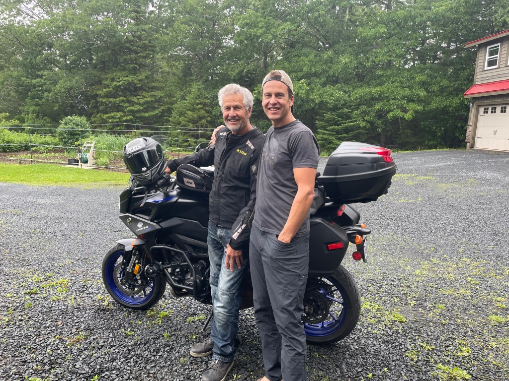
Derryl had scheduled a two-week motorbike trip – his happiest mode of transportation for exploration and a sure fix for his mental re-wind. Father and son could spend a couple days together before Derryl’s departure, and I said to Brad …. “after your Dad leaves, you and I are going hiking!”
Mom and son would enjoy a hiking extravaganza – we would start with a warm-up weekend close to home before heading off to Cape Breton to the Highlands and more.
June 30th Derryl pulled out of the driveway…
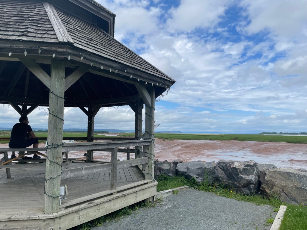
… and Brad and I left for a day-jaunt to hike and explore some sites of the Minas Basin: Wolfville, Grand Pre historical site, and Cape Blomidon.


Three days later, on a drippy Monday morning, we loaded our hiking gear and headed for Cape Breton. I had booked accommodations so no tent-camping on this trip, but our fingers were crossed. Soggy cloudy hiking isn’t always much fun.
We got our wish! The rain stopped before Canso Causeway , the link to Cape Breton – and rain showers later in the trip weren’t enough to spoil our plans.
On a previous hiking adventure in Cape Breton I’d seen Egypt Falls in the Margaree Valley: one of those well-hidden locations where Google Maps helps very little but friendly locals do a lot! Brad and I eventually found signage and reached the Falls parking lot!

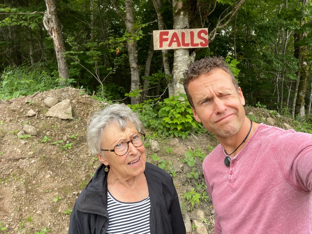
The wondering and wandering was well worth the short hike down to the waterfalls – and for Brad, enjoying the challenge of a brief, very icy dip; a solo plunge as someone had to be the photographer!

A short trek back to the car, we drove to Baddeck for supper on the wharf where we waited a long time for the food (albeit delicious when we got it) – after another half hour’s drive to our AirBnB we were more than ready for La-la land.
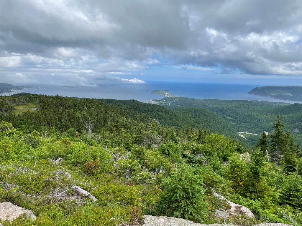
Next morning – in full sun – we were on the road, the famous Cabot Trail; stopping on Cape Smokey for a glorious cloud-studded view of the Atlantic .

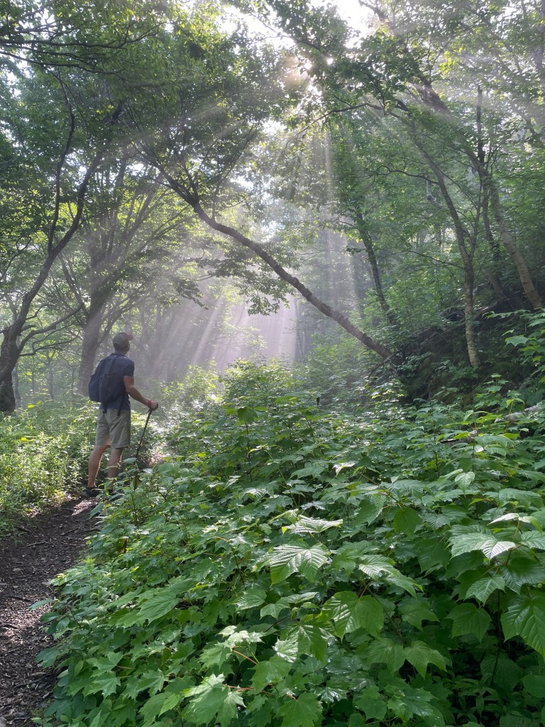
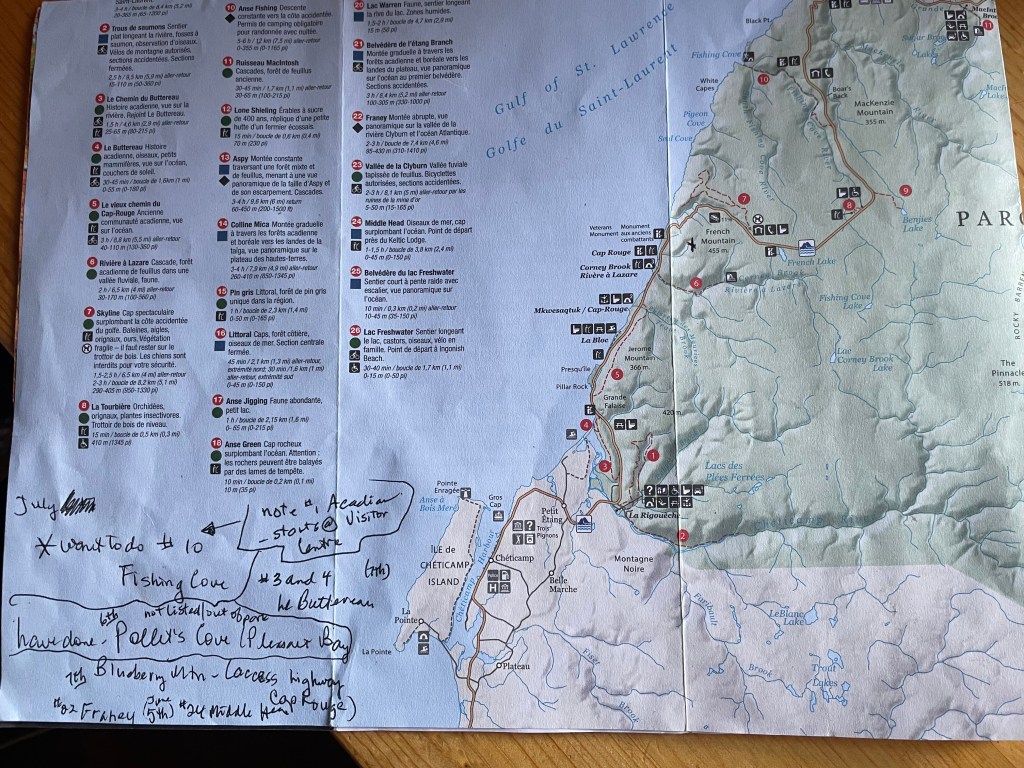
Driving further we reached the entrance to the Cape Breton Highlands National Park, where we purchased a sticker for access to the park, along with brochures for trail information and all things related to outdoor pleasures of the park.
Franey trail was first on our list: rated by the park “a steep climb to panoramic views of Clyburn River canyon and Atlantic Ocean”, it did not disappoint.

Off the trail, back at the parking lot, clouds threatening rain encouraged us to explore the sights from our car. Until we drove past the Keltic Lodge to the Middle Head trail parking lot. It was barely drizzling, it wasn’t cold, we had our rain coats; and seeing a family with a toddler in hand and pulling-pushing a stroller-wagon with another ‘little’, we had no reason to wimp out and miss this beautiful, moody-weather headland hike.

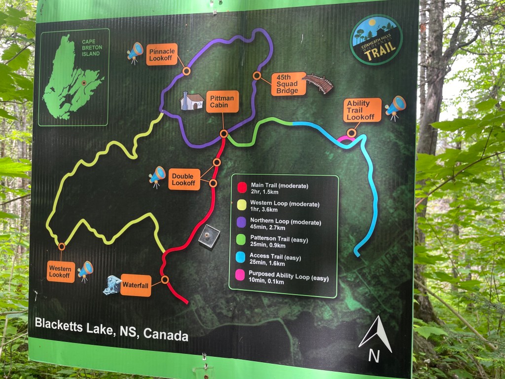
The next day we chose a hike closer to our AirBnB; Coxheath Hills Wilderness Trail near Sydney. A municipal trail with a steep incline to the apex, where the trail mostly levels off with a few ups and downs through the other loops. Beautiful sweeping views: on well-maintained trails except for the overgrown Western Lookoff, which we opted not to hike.

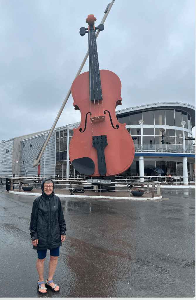
Unaware of developing rainclouds, we reached the parking lot just in time. Destination: Sydney – for a quiet afternoon, sloshing through puddles to view the harbour’s famous fiddle, then finding a pottery painting cafe for a couple hours of coffee-treats-reading our books: while creative types worked on a mug or other piece of fired clay. A perfect rainy afternoon atmosphere.
The next morning, checked out of our lodgings and headed back on the Cabot Trail to Pleasant Bay – specifically Pollett’s Cove – for our most ambitious hike of the trip.
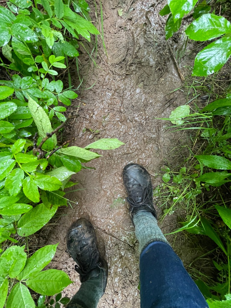
Overcast, the day looked soggier than what we’d hoped for. Regardless, we decided to ‘just check out’ the trailhead; another 10km from Pleasant Bay. I drove here a couple years ago and knew it’s a packed dirt-gravel road (or after a significant rainfall would be a muddy drive) with many large protruding rocks. Thankfully we met only a couple other vehicles, and after carefully pivoting around MANY water holes with no indication of their depth, we reached the trail parking lot. Google gives it this address: 1773 Red River Road. There was no way Brad and I were repeating this drive again. We parked the car, pulled on our raincoats and hiking shoes – neither which offered much protection from goopy mud and rain-laden bushes – grabbed our poles and set off.


We finally reached the welcome view of Pollett’s Cove, walked down to the shoreline for a short rest, waved to the folks camping in the orange tent, and a closer view of the white horses on the opposite upper ridge. On the beach there was plenty of evidence several of the herd had been freely roaming in the the Cove and surrounding landscape.
It felt like our hike back to the car went faster than our hike in – though no less messy as we tromped through the streams and slipped our way on the mud. Very ready to get to our motel – for hot showers and start cleaning off our gear – we stopped on the way for a few minutes walk through the shoreline grounds at the Gampo Abbey. It was a calming, quiet, relaxing atmosphere.
The next day was a travel home day – but we had time for a couple hikes in the National Park.
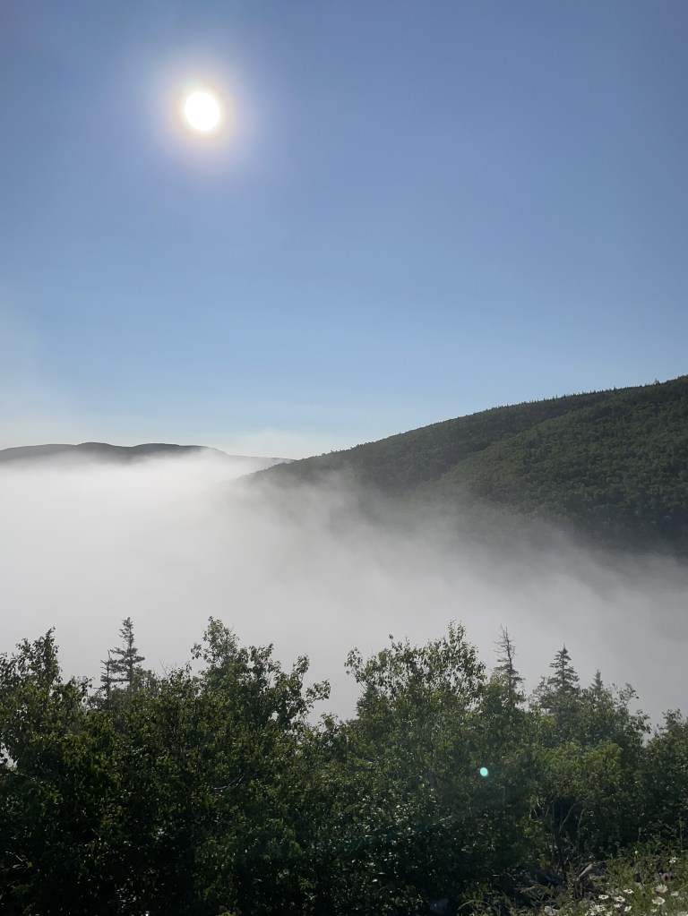
A gentleman at the motel recommended Blueberry Mountain: the trail isn’t listed in the park’s brochure but can be accessed across the highway from the Cap Rouge parking lot. We were so glad we didn’t miss this. A magical drive to the parking lot – trailhead – in sunshine above the clouds hanging over the ocean, which scattered into puffy strands once we started and summited Blueberry Mountain.
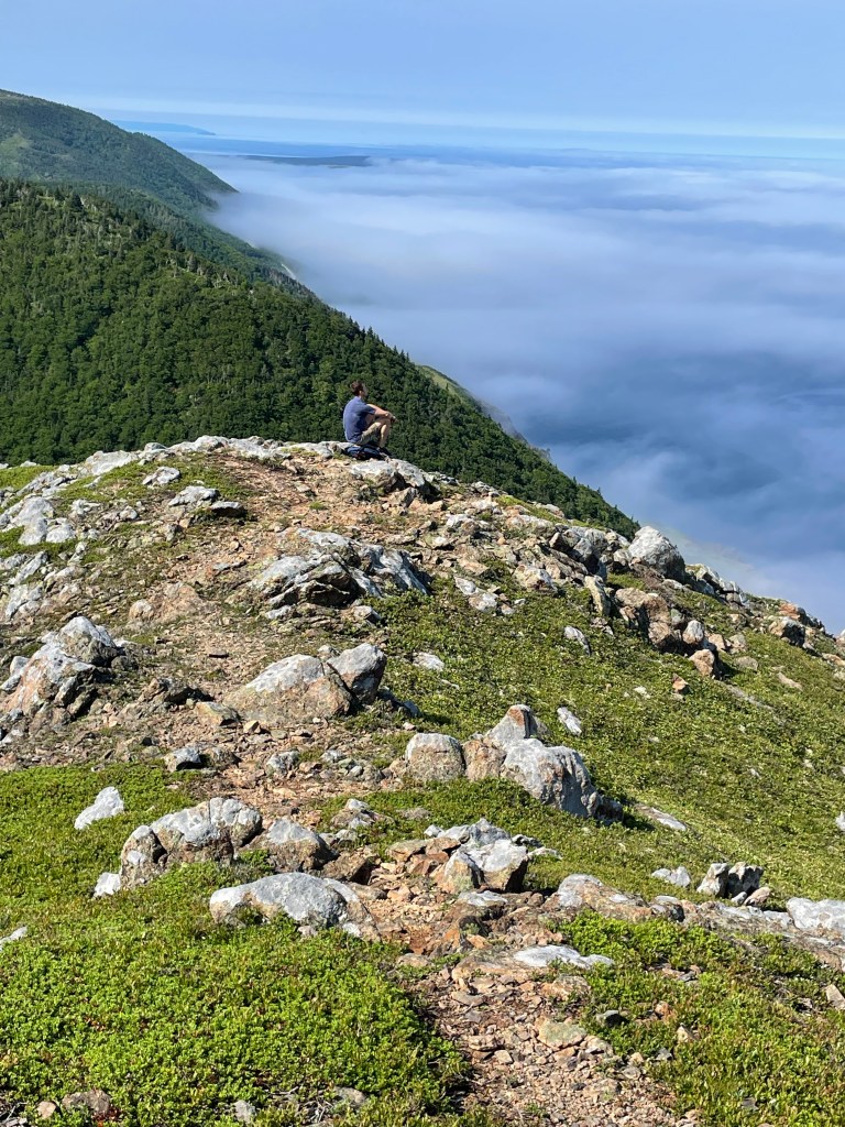
After all this beauty we didn’t want it to end. The Skyline Trail was at full capacity for hikers so we drove on to Le Buttereau for a couple hikes, a view of the ocean, discovering more Acadian history – and one more icy Atlantic dip for Brad.

Back at the car, near the exit of the Park, for fun we checked our ticket stub for accessing the park. We were within minutes of our projected time we’d hoped to spend there. Our ‘wells’ were full with the awe and beauty of nature. We had enjoyed exercise and made memories. My marked-up Park trail map – with more trails to yet explore – would have to be tucked into my Nova Scotia binder for ‘next time.’
Now, we had more beautiful miles to cover on our drive home.
Thank you Brad for our shared hiking adventure. Until the next time…
Thank you to my readers – hoping you’re also enjoying happy trails this summer..
Love,
Karen
2 Comments on “Photo-blog: Cape Breton pulls out the stops for Mom and Son hiking”
Leave a comment


Sounds like a magical trip full of good times and making special memories! Thank you so much for sharing your adventures.
Xoxo ❤️
LikeLike
Isn’t it fun when we can share such times with our adult kids?
Thanks for visiting here,
xo
Karen
LikeLike